For our mapping and surveying customers, we aim to deliver.
ACCURACY - High precision results achieving 1cm/pixel quality
SAVING - Substantial cost savings
TIME - Reduction in inspection times
Implementation
YellowFIN Robotic Solutions' fleet consists of multi rotor UAVs for Mapping, Surveying and Inspections
We have experienced teams with the rights tool to achieve what our clients require
Our team arrives at the site, plans and executes the flight within a fraction of the time required for conventional methods
We deliver the finished product usually within the same working day
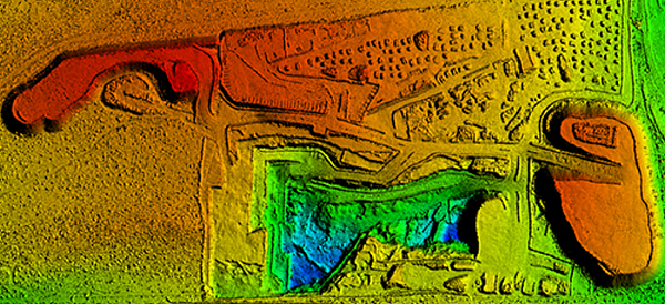
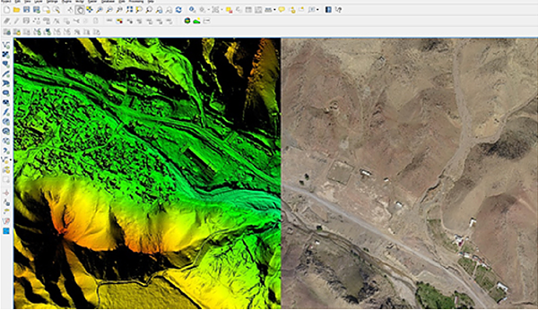
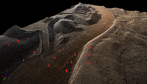
DIGITAL SURFACE & TERRAIN MODELS
Digital models that give you the elevation of each pixel, with or without above ground objects, ready for your preferred GIS workflow.
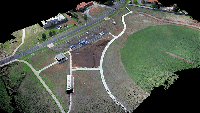
ORTHO - MOSAIC IMAGES
We can provide ortho-rectified images for your project. A high resolution map with each pixel of the original image correctly projected onto the DSM, leaving no perspective distortions with only accurate geo-locations.
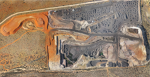
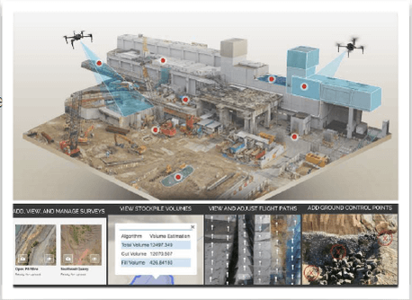
VOLUMETRIC CALCULATIONS
We can provide calculated volumes on a perfect representation of the stockpile, dug-out or trenches, with fully adjustable base heights allowing for precise measurements.
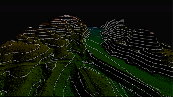
CONTUR AND TOPOGRAPHIC IMAGES
We can generate simplified representations of topography with closed contours displaying elevation.
GIS COMPATIBILIY
Export true ortho-mosaic images, DSM, DTM and 3D models for further analysis. We can provide outputs that are compatible with GIS and other professional platforms.